Foster sustainable commodity production, protect and restore forests, and enhance community livelihoods
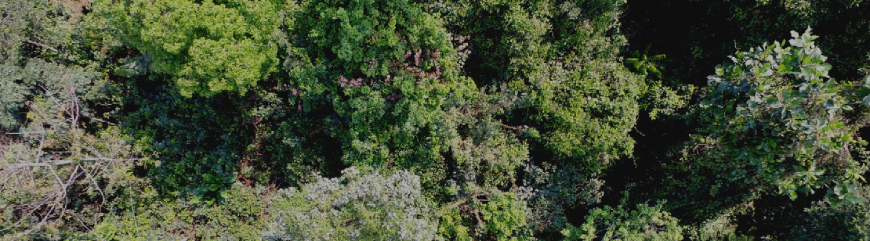
The rainforests in Cameroon cover approximately 40 % of the national territory and account for 11% of the Congo Basin forests. Cameroon has the 3rd largest forest range in the Congo Basin, after the Democratic Republic of Congo and Gabon. However, it has one of the highest rates of deforestation in the Basin, and a recent WWF report identified it as one of the 24 deforestation fronts globally. Deforestation is currently being exacerbated by tensions in the South West and North West of the country and instability in the North, which lead to increasing internal migrations, and puts extra pressure on forested land.
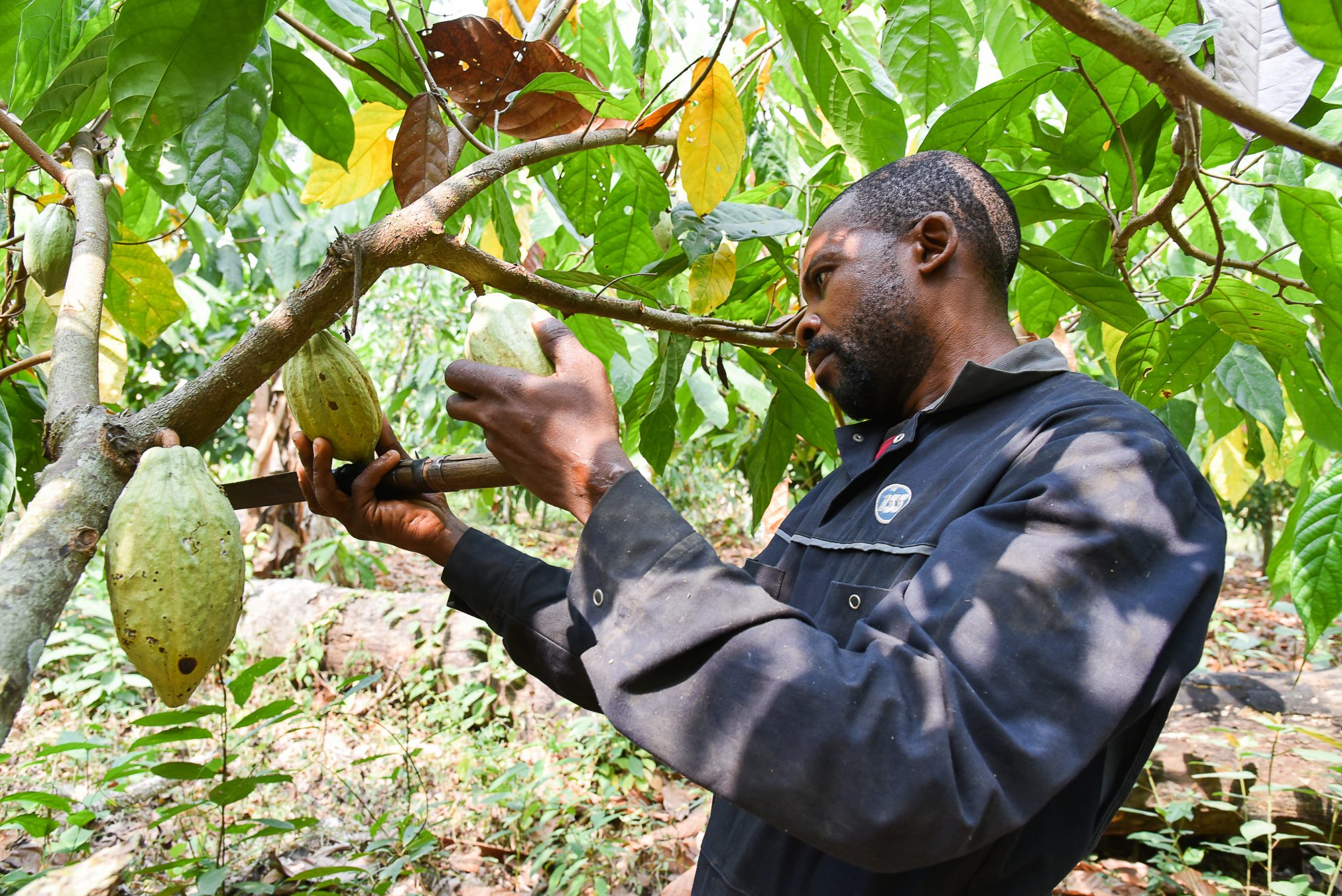
Cameroon is the 4th largest cocoa producing country in the world yet the Cameroonian cocoa sector has become characterized by poor quality, low yields leading to a decrease in farmer incomes. This leads many farmers to expand their farm into forest areas, resulting in increased forest degradation. As cocoa-related deforestation is expected to have negative impact on the cocoa sector, an increasing number of companies have committed to certified and deforestation-free cocoa.
Building on these commitments, IDH designed the “Green Commodity Landscape Program” (GCLP), which brings together key (cocoa) stakeholders to co-design and jointly implement actions that help protect forests, improve sustainable production of cocoa and enhanced livelihoods for farmers and surrounding communities in the Grand Mbam landscape. Next to cocoa, other food and cash crops (e.g. cassava) are also included in the program. Located close to the capital Yaoundé, the Grand Mbam landscape accounts for over a quarter of national cocoa production. Its rolling forested hills up to 1000 m in elevation are under growing threats from illegal logging, expanding subsistence farming and poorly managed cocoa production.
Connected to the GCLP, IDH and partners co-developed a Roadmap to Deforestation-free Cocoa at national level. This roadmap supports the design and implementation of new policy instruments, guidelines and plans to tackle cocoa-related deforestation in Cameroon. These instruments and guidelines are piloted in municipalities selected by the GCLP.
Together, the Roadmap and the GCLP coordinate national and local levels as well as business and private efforts to work towards increased sustainable production, protection and restoration of forests and enhanced farmer livelihoods.
The Green Commodity Landscape Program and PPI
The Green Commodity Landscape Program in a nutshell
The Green Commodity Landscape Program (GCLP) strategy is based on a Landscape approach in which industry partners (from cocoa and other sectors), public partners, financiers, CSOs and knowledge partners work together, through the development of land-use plans that protect forests, address the needs of local communities, and help make cocoa farming a sustainable livelihood option. See also Production, Protection and Inclusion.
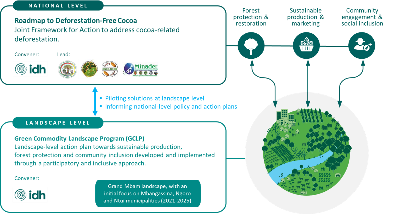
The Roadmap to Deforestation-free Cocoa, is the overarching framework that supports the GCLP. It is led by the Ministry of Agriculture and Rural Development (MINADER), in close collaboration with the Ministry of Forests and Wildlife, Ministry of Environment, Nature Protection and Sustainable Development, and Ministry of Trade, while IDH facilitates the process.
The Landscapes
1. The Grand Mbam Landscape
The Grand Mbam landscape is found in the forest-savannah transition zone consisting of rolling forested hills (200-1,000m altitude above sea level) interspersed with valleys and woodland savannah. This landscape covers 14 municipalities in two Départements (Divisions) – Mbam et Inoubou and Mbam et Kim. Most of the population (an estimated 217,000 people) is made up of a migrant settler population, which remained in the area after the forestry companies that brought them to work in the area left. They then opened cocoa farms and have since then constituted themselves into communities and encouraged and facilitated relatives to relocate to the area.
The municipalities of Mbangassina, Ntui and Ngoro were selected as the priority municipalities of the program within the Grand Mbam landscape due to their accessibility, high cocoa production and relatively strong engagement of the private sector in developing the cocoa value chain.
Within the Grand Mbam landscape, the municipality of Mbangassina will be the initial focus of the program.
- Mbangassina Municipality
Mbangassina municipality is located in the centre region, Mbam and Kim Division, and is made up of 19 villages.
It is located on both banks of the Mbam river, 120 km from Yaoundé, and covers a total surface area of about 815km². The municipality is bordered to the north by the municipality of Ngoro, and to the east by Ntui. The landscape is dominated by cocoa agroforestry and patches of secondary forest with large savannah area. It is neighboured by 3 community forests specifically from Ngoro and Ntui municipalities, which we identified as areas where to pilot production-protection-inclusion interventions.
Cocoa Production and Food crops:
Cocoa is the main source of livelihood in the municipality. According to the baseline study conducted by ICRAF in 2020 96% of the sampled population indicated that cocoa was one of their main sources of income, while 79% depends on food crops (cassava, yam, plantain, maize), 23% on tree crops (Fruit trees, NTFPs), 11% on small businesses, 5 % generate their revenue from livestock and 4% from pension.
In terms of gender roles, men tend to dominate the cocoa value chain. Women tend to be involved in the collection and opening of cocoa pods. Women however tend to dominate the food crop value chain.
Expansion of cocoa farms and settlement are key drivers of deforestation:
Expansion of cocoa farms, settlement and food crop are the most important drivers of deforestation (Source: ICRAF, 2020). This can be explained by the increasing population of the area which leads to increasing pressure on forest land for agriculture, and land for settlement.
Read the Baseline Study to learn more about Mbangassina municipality here: Baseline Study Report-Mbangassina Municipality- 181220
Statistics of the Mbangassina municipality:
| Total land cover | 81,603 ha |
| Total primary forest cover | 18,176 ha |
| Total secondary forest cover | 21,431 ha |
| Total cropland | 10,930 ha |
| Total shrubland | 10,867 ha |
| Total cocoa | 9,158 ha |
| Total grassland | 7,005 ha |
| Total water | 3,281 ha |
| Total urban | 747 ha |
| Total oil palm | 3,4 ha |
| Total rubber | 0 |
| Total population | 68 208 (44% male, 56% female) |
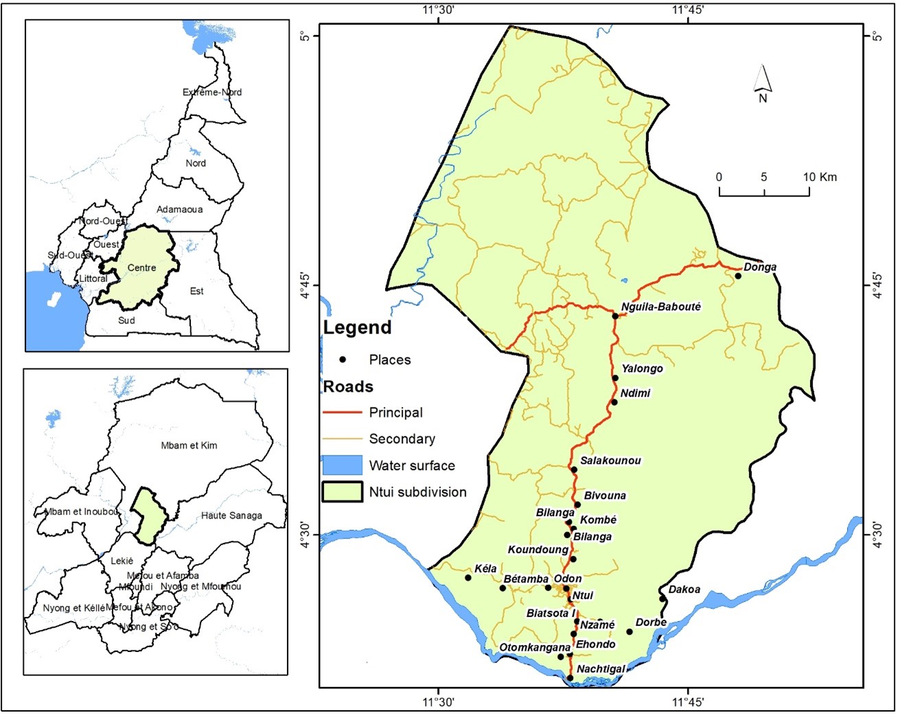
- Ntui Municipality
The municipality of Ntui is the chief town of the Mbam and Kim Division, in the Central region and is made of 27 villages. With a population of 25,618 people (2010 census), it covers 1650 km2. Ntui is in the dense tropical forest and consequently has a high biodiversity of fauna and flora.
Cocoa Production and Food crops:
According to the baseline study conducted by Fokabs in 2020, agriculture is the main source of revenue in the municipality, with cocoa (2,500t/year), banana-plantain (25t), cassava (15t) and corn (10t) being the main cultivated crops. Cocoa is grown in both forest and savannah areas in the municipality.
The gender roles in cocoa are similar to the ones observed in Mbangassina, with only few women owning cocoa plantations.
Land use change, driver of deforestation and future trends of deforestation
Deforestation in the Municipality of Ntui is historically linked to agriculture and in particular to the expansion of crops, notably cocoa cultivation through slash-and-burn. New plantations are being opened under the impetus of city dwellers who appropriate the plantations to ensure a complementary income, a pension or a land base. Subsistence farming is also one of the drivers of deforestation and forest degradation in the municipality.
- Ngoro Municipality
The Municipality of Ngoro located about 160 Km North of the Yaoundé city and is made of 24 villages. It covers 1576 km2 and has an estimated population of 20,829 inhabitants (PCD, 2022), with the highest population growth rates in the Division of Mbam and Kim. Ngoro is covered mostly by forests, followed by wooded and grassy savannah.
Cocoa Production and Food Crops:
According to the baseline study conducted by Fokabs in 2020, cocoa, banana/plantain and macabo are the most cultivated crops in the landscape.
Many farmers in the Ngoro landscape cultivate farms in the forest (72%), and secondly in woddy savannahs (28%).
Land use change, driver of deforestation and future trends of deforestation
Direct drivers of deforestation/degradation in Ngoro Landscape are agriculture, artisanal timber exploitation, while indirect drivers of deforestation are demographic growth and economic crisis coupled with migration.